Matthew Durst
GIS Specialist

Matt previously Worked for the Addison County Regional Planning Commission, where he conducted Culvert Inventories and furthered his GIS expertise. Matt has a wide range of experience with public education and outreach: he has worked as a Physics TA in college, organized Astronomy Outreach community events, and promoted Shacksbury Cider at public events. As GIS Specialist, Matt manages Lead Service Line Inventories and leverages GIS capabilities for data management, streamlined workflows, and figure production. He sees his work as producing effective visual storytelling through interactive mapmaking, alongside data organization and management for environmental and public health projects.
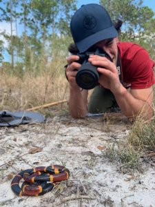
In his free time, Matt enjoys exploring nature for mushrooms and snakes. After stumbling upon three red diamond rattlesnakes in 2018, Matt became hooked on finding snakes in the wild and has traveled all across the country to observe over 90 unique species of snake firsthand. He regularly contributes his findings to the Vermont Reptile and Amphibian Atlas.
|
Matt gets up close and personal with an Eastern Coral Snake. |
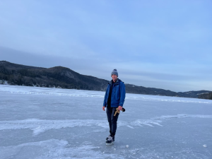
When not searching out snakes and mushrooms, Matt enjoys the outdoors in all its guises. |
|---|